What is Fir Grove Recreation Site
Fir Grove Recreation Site is a small but very beautiful campground located on Lower Campbell Lake on Vancouver Island, British Columbia Canada. I spent a week there and couldn’t be more pleased with the outcome.
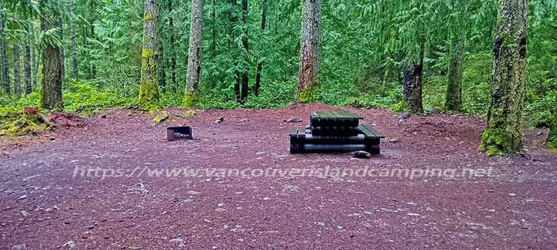
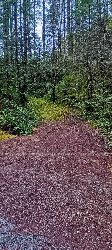
There are two campsites with picnic tables, fire rings and one pit toilet between them. The first campsite is set back away from the lake with a trail down to it. The second campsite is situated on the water front with a clear view of the lake.
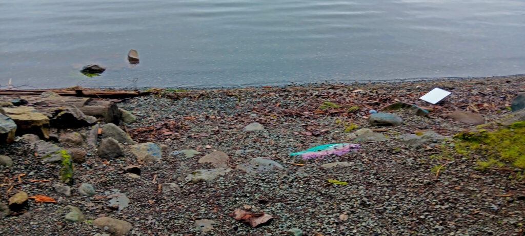
There is a beautiful sandy beach which may be larger during the summer season as water levels (controlled by John Hart Dam) drop. A natural boat ramp exists but someone has placed big rocks buried in the sand which would make it difficult for anything but a 4×4 or all wheel drive with good clearance to back down.
How to Get to The Campground
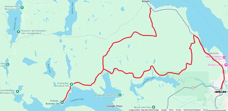
First you will need to find your way to Vancouver Island, British Columbia Canada. Once you arrive on the island make your way up island to Campbell River. From there follow the signs towards Sayward.
Along the way keep an eye out for the “Alternate Route” signs for Loveland Bay. About 7-8 km from crossing the bridge over the Campbell River you’ll see a road on the left called Duncan Bay. Turn here and follow the road (1-2km) until it becomes Gordon Road (staying to your left).
Follow Gordon Road for about 2.4 km and turn left again onto Brewster Lake road. There is a Nursery business at this junction with large greenhouses for growing coniferous trees for the forest industry. Follow Brewster Lake Road for about 1.5 km and turn right onto Loveland Bay Road. You will see a large green sign with distances to various recreation sites which tells you your on the right road.
Drive another 11 km and turn left on to Campbell Lake road and go to the 6.5 km mark. Here you will see a road to your left it is very well maintained for a small dirt road into the campground. There used to be a Fir Grove sign on the tree at the entrance but it has since disappeared.
Another route would be to drive towards Sayward about 12-14 km and turn left onto the Iron River Road. From there drive 4km and turn right onto the Snowden Forest Road. From there it is about 9-10 km to the Loveland Bay, Brewster Road junction where the road turns into Campbell Lake Main. Then go to the 6.5 km mark and turn left.
Very Little Room To Turn Around in The Campsite
If you are towing a trailer it would be wise to walk the 5 minutes into the campground to ensure no one is there as turning around isn’t easy. There is a bit of a lane next to the Fir Grove Recreation Site sign so depending on your skill set you could back into it and turn back out. There is a small ditch so you may have to use dunnage (wood etc) to avoid damaging your trailer if you cannot turn wide enough to avoid it.
I have a pickup/slide in camper and utility trailer behind me so I always walk in to avoid any costly mistakes even though I probably wouldn’t have any issues. Better to be safe than sorry I always say.
For the record I have seen some larger trailers backed into both campsites so it can be done with caution and a spotter. One commenter on my Facebook page stated in the past they used to disconnect and turn their trailer around by hand. Just be aware first before attempting it blind. Hence the short walk.
How To Get To Fir Grove Recreation Site Using Google Maps
Just fill in your current location where you will be leaving and the map will open with all the pertinent information for your travels.
Tidbits
Summing Up Fir Grove Recreation Site
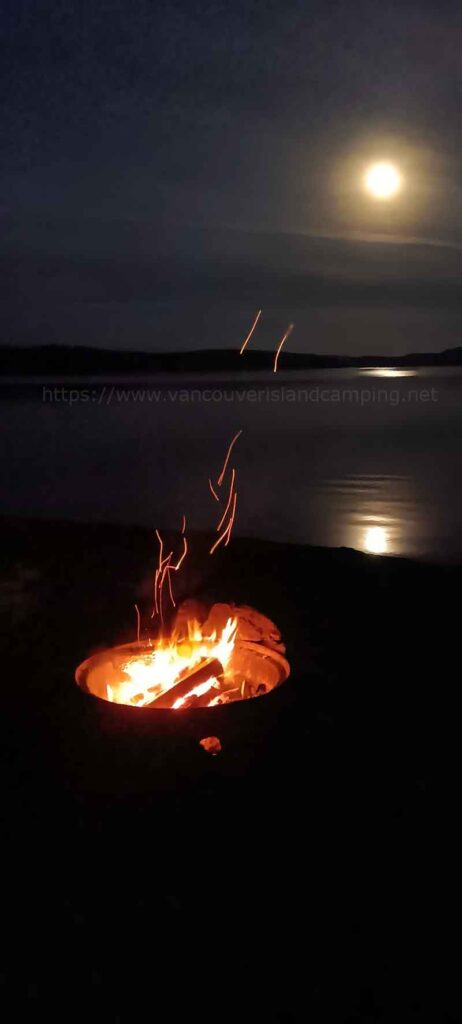
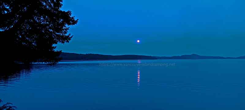
To me this is one of the nicest little campgrounds for its size. I really enjoyed my stay here sitting around the campfire over looking Lower Campbell Lake. I even got to watch the Blood Moon on my first night as it was for the most clear. Didn’t have the right camera equipment though to get a good photo of it. Did manage to get off a shot which just looks like a full moon but still nice none the less.
The only wildlife I saw during my stay was a couple of Loons working the waters out front and some Kingfishers also working the shoreline. I did hear some geese off in the distance and I thought I heard some Mergansers also. Of course all the usual birds were in attendance like Eagles, Robins, Thrushes, Chickadees and Rufus Sided Towhees. No tracks of any kind to indicate deer, bear or cougars although I know from experience they are in the area.
As for fishing the water along the shore line is too shallow for casting so I decided not to waste my time. However, in the past I have fished off shore in my 12′ aluminum boat before I got rid of it. I had good success catching Cutthroat Trout from it in Lower Campbell Lake everywhere I tried.
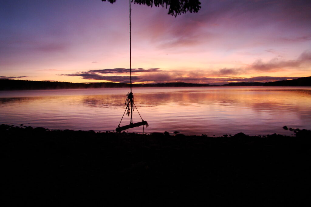
There is a tree that hangs over the water and it used to have a swing from a previous visit now it is only a broken rope. When you look at the trees root structure in the bank, it doesn’t look to long for this world either. Looks like it used to be a lot of fun when the high water is here though. I seem to remember having a photo when the swing was intact. I’ll see if I can find it for reference.
Please Leave Comments or Ask Questions About Fir Grove Recreation Site Below
Above all, don’t be shy.
Please leave us some comments good or bad. It doesn’t matter as we love hearing from you regarding our website, articles and what you’d like us to do to make this website better suited for your needs.
We’ll always reply with 48 hours to your comments or questions.
Please be courteous and polite though even if you disagree with something as no one likes a bully. Also don’t post negative comments about giving away secret campsites or “your campsites” as they are illogical in a legal sense and selfish.
Also don’t forget to share and like us with your favorite social media site using the buttons at the top of the page or below so we can get the word out there about the beautiful camping opportunities that exist on Vancouver Island. This way others can find us for a visual of the campground and pertinent details.
Check out our YouTube channel for more great videos on camping around Vancouver Island.